
The Peninsular plateau is a tableland made up of crystalline, igneous, and metamorphic rocks. It was produced by the breakup and drifting of the Gondwana continent, making it the oldest landmass on the planet. Tors, block mountains, rift valleys, spurs, bare rocky formations, series of hummocky hills, and wall-like quartzite dykes are some of the region’s key physiographic characteristics, which provide natural water storage sites.
The Peninsular Plateau
- The Peninsular plateau is a tableland made up of old crystalline, igneous, and metamorphic rocks.
- It was developed as a result of the breakup and drifting of the Gondwana continent, making it one of the oldest landmasses.
- The plateau has large and shallow valleys as well as rounded hills.
- This plateau is divided into two sections: the Central Highlands and the Deccan Plateau.
- The Central Highlands are the parts of the Peninsular plateau to the north of the Narmada river that cover a large portion of the Malwa plateau.
- The general height of the plateau is from west to east, as seen by the direction of river flow.
- This Peninsular plateau has seen recurring periods of uplift and submergence, which have been accompanied by crustal faulting and fractures.
- The relief of the Peninsular plateau has become more diverse as a result of these spatial variations.
Features
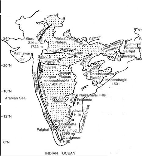
- It is roughly triangular in form, with its base coincident with the southern boundary of North India’s vast plain. Kanyakumari is the triangular plateau’s apex.
- It has a total size of around 16 lakh square kilometres (India as a whole is 32 lakh sq km).
- The plateau’s typical elevation is 600-900 m above sea level (varies from region to region).
- The majority of the peninsular rivers run west to east, illustrating the overall slope of the peninsula.
- The Narmada-Tapti rivers are the exceptions, flowing from east to west in a rift (rift formed by diverging border)
- The Peninsular Plateau is one of the world’s oldest landforms.
- It is a highly stable block made up primarily of Archaean gneisses and schists.
- It has remained a stable shield with little structural modifications since its construction.
- The Peninsula has remained a land region for a few hundred million years and has never been submerged beneath the sea except in a few locations.
- The Peninsular Plateau is made up of multiple smaller plateaus and hill ranges that are interlaced by river basins and valleys.
Minor Plateaus in Peninsular Plateau
Central High Land
- Madhya Bharat Pathar or Madhya Bharat Plateau are other names for the Central HighLand.
- It’s located to the east of the Marwar or Mewar Upland.
- The majority of the plateau is made up of the Chambal river basin, which runs in a rift valley.
- Its main tributaries are the Kali Sindh, which flows from Rana Prataph Sagar, the Banas, which flows through the Mewar plateau, and the Parwan and Parbati, which come from Madhya Pradesh.
- It is a sloping plateau with rounded sandstone hills. Thick woodlands may be found here.
- To the north are the Chambal river’s ravines or badlands.
Marwar Plateau
- It is the eastern Rajasthan plateau. The Marwar plain lies to the west of Aravalis, while the Marwar plateau is to the east.
- The typical elevation is 250-500 m above sea level, and the terrain slopes eastward.
- It is composed of Vindhyan period sandstone, shales, and limestones.
- The Banas River and its tributaries (Berach and Khari rivers) rise in the Aravali Range and flow northwest into the Chambal River. Because of the erosional activity of these rives, the plateau top seems to be a rolling plain.
Bundelkhand Plateau
- The Yamuna River runs through the north, the Madhya Bharat Pathar runs through the west, the Vindhyan Scarplands go through the east and south-east, and the Malwa Plateau runs through the south.
- It is the ancient dissected (split by several deep valleys) upland of the ‘Bundelkhand gneiss,’ which is made up of granite and gneiss.
- It is divided into five districts in Uttar Pradesh and four districts in Madhya Pradesh.
- This region has an average height of 300-600 m above sea level and dips down from the Vindhyan Scrap toward the Yamuna River.
- A chain of hillocks (little hills) built of granite and sandstone define the region.
- The erosion process of the rivers that pass through here has changed it into an undulating (wave-like surface) land that is unsuitable for farming.
- The topography of the region is characterised by senile (typical of or produced by old age).
- The plateau is traversed by streams such as Betwa, Dhasan, and Ken.
Malwa Plateau
- The Malwa Plateau generally forms a triangle centred on the Vindhya Hills, delimited in the west by the Aravali Range, in the north by Madhya Bharat Pathar, and in the east by Bundelkhand.
- This plateau has two drainage systems, one towards the Arabian Sea (through the Narmada, Tapi, and Mahi) and the other towards the Bay of Bengal (Chambal and Betwa, joining the Yamuna).
- The Chambal and many of its right bank tributaries, including the Kali, Sindh, and Parbati, drain it in the north.
- It also covers the upper courses of the Sindh, Ken, and Betwa rivers.
- It is made up of vast lava flows and coated with black soils.
- The overall slope is northward [from 600 m in the south to less than 500 m in the north].
- This is a river-cut plateau with undulating hills. The Chambal ravines delineate the plateau to the north.
Baghelkhand Plateau
- Baghelkhand is located north of the Maikal Range.
- On the west, it is composed of limestones and sandstones, whereas on the east, it is composed of granite.
- In the north, it is surrounded by the Son River.
- The plateau’s middle section serves as a water divide between the Son drainage system to the north and the Mahanadi river system to the south.
- The terrain is uneven, with elevations ranging from 150 to 1,200 metres.
- The Bhanrer and Kaimur are situated near the trough-axis.
- The overall horizontality of the strata indicates that no substantial disturbance has occurred in this location.
Chotanagpur Plateau
- The Chotanagpur plateau is the Indian Peninsula’s north-eastern protrusion.
- Mostly in Jharkhand, northern Chhattisgarh, and West Bengal’s Purulia area.
- The Son river travels through the plateau and enters the Ganga.
- The plateau’s average elevation is 700 metres above sea level.
- This plateau is mostly made up of Gondwana rocks.
- The plateau is drained in various directions by multiple rivers and streams, resulting in a radial drainage system. Pattern of Drainage
- Rivers such as the Damodar, Subarnarekha, North Koel, South Koel, and Barkar have formed enormous drainage basins.
- The Damodar River flows through the centre of this area, forming a rift valley from west to east.
- The Gondwana coal fields, which supply the majority of India’s coal, are located here.
- The Hazaribagh plateau, located north of the Damodar river, has an average height of 600 metres above mean sea level.
- There are solitary hills on this plateau. Because of large-scale erosion, it seems to be a peneplain.
- To the south of the Damodar Valley, the Ranchi Plateau rises to around 600 m above mean sea level. Where the city of Ranchi (661 m) is located, the majority of the terrain is rolling.
- Monadnocks (an isolated hill or ridge of erosion-resistant rock rising above a peneplain) interrupt it in spots. Ayers Rock in Australia is an example of a conical hill.
- The Rajmahal Hills, which comprise the northwestern boundary of the Chotanagpur Plateau, are largely formed of basalt and are covered with basaltic lava flows.
- They go north-south and reach an elevation of 400 m on average (highest mount is 567 m). These hills have been subdivided into plateaus.
Meghalaya Plateau
- Beyond the Rajmahal hills, the peninsular plateau stretches eastward to Meghalaya or the Shillong plateau.
- This plateau is separated from the main block by the Garo-Rajmahal Gap.
- This chasm was created via down-faulting (normal fault: a block of earth slides downwards). Sediments deposited by the Ganga and Brahmaputa later filled it.
- Archaean quartzites, shales, and schists make up the plateau.
- The plateau descends down to the north to the Brahmaputra river and south to the Surma and Meghna valleys.
- Its western border is roughly parallel to the border with Bangladesh.
- The plateau’s western, middle, and eastern sections are known as the Garo Hills (900 m), Khasi-Jaintia Hills (1,500 m), and Mikir Hills, respectively (700 m).
- Shillong (1,961 m) is the plateau’s highest peak.
Deccan Plateau
- It has a land area of around 500,000 square kilometres.
- It is triangular in shape and is limited in the north-west by the Satpura and the Vindhya, in the north by the Mahadev and the Maikal, in the west by the Western Ghats, and in the east by the Eastern Ghats.
- It has an average elevation of 600 metres.
- It reaches 1000 metres in the south but drops to 500 metres in the north.
- The flow of its principal rivers indicates that its overall slope is west to east.
- Rivers have fragmented this plateau into several smaller plateaus.
Maharashtra Plateau
- It is located in the northern section of the Deccan Plateau.
- Much of the land is underlain by basaltic lava rocks, the majority of the Deccan Traps are located in this region.
- Weathering has given the land the appearance of a rolling plain.
- Horizontal lava sheets have resulted in typical Deccan Trap topography.
- The large and shallow basins of the Godavari, Bhima, and Krishna rivers are flanked by flat-topped steep-sided hills and mountains.
- The entire region is covered with regur, a black cotton soil.
Karnataka Plateau
- The Mysore plateau is another name for the Karnataka Plateau.
- It is located to the south of the Maharashtra plateau.
- The terrain seems to be an undulating plateau with an average elevation of 600-900 metres.
- It is heavily crisscrossed by various rivers that flow from the Western Ghats.
- The hills’ basic tendency is either parallel to or across the Western Ghats.
- Mullayanagiri, in the Baba Budan Hills of Chikmagalur district, has the highest peak (1913 m).
- The plateau is separated into two sections known as Malnad and Maidan.
- Malnad is Kannada for “high country.” It is divided among deep valleys with lush trees.
- The Maidan, on the other hand, consists of an undulating plain with modest granite hills.
- In the south, the plateau tapers between the Western and Eastern Ghats and merges with the Nilgiri hills.
Telangana Plateau
- Archaean gneisses make up the Telangana plateau.
- It has an average elevation of 500-600 metres.
- The southern section is higher than the northern section.
- Three river systems, the Godavari, the Krishna, and the Penneru, drain the area.
- The plateau is separated into two sections: the Ghats and the Peneplains (a vast featureless, undulating plain which is the last stage of the deposition process).
Chhattisgarh Plain
- The Chhattisgarh plain is the Peninsular plateau’s sole plain worthy of the term.
- The upper Mahanadi drains this saucer-shaped valley.
- The basin as a whole is located between the Maikala Range and the Odisha hills.
- The territory was originally dominated by the Haithaivanshi Rajputs, whose thirty-six forts (Chhattisgarh) gave rise to the region’s name.
- The basin is composed of almost horizontal strata of limestone and shales.
- The plain’s overall elevation fluctuates from 250 m in the east to 330 m in the west.
Rivers in Peninsular Plateau
- The Mahanadi, Godavari, Krishna, Cauvery, Narmada, and Tapti or Tapi rivers are among India’s peninsular rivers.
- They collectively drain a sizable section of rural India. In the life of Indians, these rivers have religious and cultural importance.
- The Kaveri River is another name for the Cauvery River. It is one of the Hindu rivers that are considered sacred.
- The river’s headwaters are in the Western Ghats Mountain Range, in Talakaveri in Karnataka’s Kodagu District. The river flows from the south Deccan hills to the southeast lowlands.
- The Godavari is South India’s longest and largest river. The Dakshina Ganga is another name for it.
- The Godavari is India’s second-longest river, behind the Ganga.
- The river originates in the Maharashtra district of Nashik. The river empties out into the Bay of Bengal.
- The Mahanadi River is a significant river in Eastern India. The river runs about 900 kilometres.
- The Mahanadi River flows through states such as Chhattisgarh, Orissa, and Jharkhand.
- The Krishna River is a significant river in South India. The river is sometimes referred to as the Krishnaveni. The Krishna flows through Maharashtra, Karnataka, and Andhra Pradesh.
- The Narmada is one of Western India’s most beautiful rivers. The river’s headwaters are located on Amarkantak Hill. Rewa is another name for the river.
- The Tapi or Tapti River is a major river in peninsular India. The river rises in the East Satpura Mountain Ranges in Madhya Pradesh.
- The rivers of the Indian peninsular landscape are mostly supplied by rain. During the summer, their discharge is greatly reduced.
- Some of its tributaries even get desiccated, only to be replenished during the monsoon season.
Significance of Peninsular Plateau
- This Peninsular plateau has seen recurring periods of uplift and submergence, which have been accompanied by crustal faulting and fractures.
- The relief of the Peninsular plateau has become more diverse as a result of these spatial changes.
- The plateau’s northern region features a complicated terrain with ravines and gorges. Some well-known examples include the ravines of Chambal, Bhind, and Morena.
- There are massive reserves of iron, manganese, copper, bauxite, chromium, mica, gold, and other minerals.
- The Peninsular Plateau has 98% of India’s Gondwana coal resources.
- Aside from that, there are vast quantities of slate, shale, sandstones, marbles, and so forth.
- A major portion of the northwestern plateau is covered in fertile black lava soil, which is ideal for cotton cultivation.
- Some hilly locations in south India are ideal for growing plantation crops such as tea, coffee, rubber, and so on.
- Rice may be grown in some low-lying regions of the plateau.
- The plateau’s highlands are covered with several types of forests that provide a wide range of forest products.
- The rivers that originate in the Western Ghats provide excellent opportunities for creating hydroelectricity and supplying irrigation for agricultural crops.
- The plateau is also well-known for its hill resorts, which include Udagamandalam (Ooty), Pachmarhi, Kodaikanal, Mahabaleshwar, Khandala, Matheron, and Mount Abu.
Conclusion
The Peninsular plateau is a tableland made up of crystalline, igneous, and metamorphic rocks from the past. It was produced by the breakup and drifting of the Gondwana continent, making it the oldest landmass on the planet. Its base coincides with the southern boundary of the broad plain of North India, giving it a roughly triangular form. Kanyakumari is the highest point on the triangular plateau.
Indian Monsoon
- The word ‘monsoon’ is believed to have originated from the Arabic word for season ‘mawsim’. Monsoons are basically seasonal winds that reverse their direction according to the change in season. They are hence, periodic winds.
- The monsoons travel from the sea to the land in summers and from land to the sea during winters, hence, are a double system of seasonal winds.
- Some scholars tend to treat the monsoon winds as land and sea breeze on a large scale.
- Historically the monsoons have been very important because these winds were used by traders and seafarers to move from place to place. Though there is monsoon in the Indian subcontinent, central-western Africa, Southeast Asia, and a few other places, the winds are most pronounced in the Indian subcontinent.
- India gets southwest monsoon winds in the summers and northeast monsoons during the winters. The former arise because of the formation of an intense low-pressure system over the Tibetan Plateau. The latter arises due to the high-pressure cells that are formed over the Siberian and Tibetan plateaus.
- South-west monsoons bring intense rainfall to most of the regions in India and north-east monsoons bring rainfall to mainly south-eastern coast of India (Southern coast of Seemandhra and the coast of Tamil Nadu.).
- Countries like India, Indonesia, Bangladesh, Myanmar etc. receive most of the annual rainfall during south-west monsoon season where as South East China, Japan etc., during north-east rainfall season.


Mechanism of Indian Monsoon
The monsoons are experienced in the tropical area roughly between 20° N and 20° S. Monsoon is a complex meteorological phenomenon. The origin of monsoons is not fully understood. There are several theories that tried to explain the mechanism of monsoons. To understand the mechanism of the monsoons, the following facts are important
Thermal Concept
- Halley, a noted astronomer, made a hypothesis that the primary cause of the Indian monsoon circulation was the differential heating effects of the land and the sea. According to this concept, monsoons are the extended land breeze and sea breeze on a large scale. During winter the huge landmass of Asia cools more rapidly than the surrounding oceans with the result that a strong high-pressure centre develops over the continent. On the other hand, the pressure over adjacent oceans is relatively lower. As a consequence the pressure- gradient is directed from land to sea. Therefore there is an outflow of air from the continental landmass towards the adjacent oceans so that it brings cold, dry air towards the low latitudes.
- In summer, the temperature and pressure conditions are reversed. Now, the huge landmass of Asia heats quickly and develops a strong low-pressure centre. Moreover, the poleward shift of the Intertropical Convergence Zone (ITCZ) to a position over Southern Asia reinforces the thermally induced low-pressure centre. The pressure over the adjacent oceans being high, a seato-land pressure gradient is established. The surface airflow is, therefore, from the highs over the oceans towards the lows over the heated land. The air that is attracted into the centers of low pressure from over the oceans is warm and moist.
- Halley’s concept is criticized on the following lines:
- It fails to explain the intricacies of monsoon such as the sudden burst of monsoon, breaks in monsoon, the spatial and temporal distribution of monsoon. The low-pressure areas are not stationary. The rainfall is not only convectional but a mix of orographic, cyclonic, and convectional rainfall.
Recent Concept about the Origin of Indian Monsoon
After world war second, the upper atmospheric circulation has been studied significantly. It is now believed that the differential heating of sea and land alone can’t produce monsoon circulation. Apart from it, the recent concept of monsoon rely heavily on the role of
- Himalayas and Tibetan plateau as a physical barrier and a source of high-level heat.
- Circulation of upper air jet streams in the troposphere.
- Existence of upper air circum-polar whirl over north and south poles in the troposphere.
- The occurrence of ENSO (El-Nino and Southern Oscillation) in the South Pacific ocean
- Walker cell in Indian Ocean.
- Indian Ocean Dipole
Role of the Himalayas and Tibetan Plateau
- In the 1970s, it was found that the Tibet plateau plays a crucial role in initiating the monsoon circulation. The plateau of Tibet extends over an area of about 4.5 million sq. km. The average height of these highlands is 4000 m. Due to its enormous height, it receives 2-3oC more insolation than the neighboring areas. The heating of these areas leads to clockwise air circulation in the middle troposphere and two-wind streams originate from this area. One of these wind streams blows southward and develops into the tropical easterly jet stream (TEJ). The other stream blows in an opposite direction towards the North Pole and becomes the westerly jet stream over Central Asia.

Role of Jet Stream
- As already discussed, the sub-tropical westerly jet stream is bifurcated by the high-land Tibet in winters. The northward branch extends up to 20N-35N. Tropical easterly jet stream (TEJ), that branch off from anticyclone developed over Tibet, sometimes reaches to the tip of Peninsular India. Apart from this, Jet speed winds are also reported over other parts of Peninsular. This jet descends over the Indian Ocean and intensifies its high-pressure cell known as Mascarene High. It is from this high-pressure cell that the onshore winds start blowing towards the thermally induced low-pressure area, developed in the northern part of the Indian subcontinent. After crossing the equator such winds become south-westerly and are known as the southwesterly summer monsoon.


Role of ENSO
- The Indian monsoon is also influenced by EL-Nino, southern oscillation, and Somalian current. We know that El Nino is the reversal of normal conditions in the Pacific Ocean’s sea surface temperature. Though there is no direct correlation between bad monsoon and El Nino, but both are generally associated. There are years when India faced severe drought and those are not El -Nino years and vice-versa. Southern Oscillation is the see-saw pattern of atmospheric pressure between the eastern and western Pacific oceans. The oscillation has a period varying from 2-7 years. It is measured with Southern Oscillation Index (SOI) by measuring the pressure difference between two points in the Pacific Ocean (Tahiti and Darwin). A negative value of SOI implies high pressure over the north Indian Ocean during the winter season and a poor monsoon.
- The Somalian current changes its direction of flow after every six months. During the North-East Monsoon, the Somali Current flows to the south-west, while during the South-West Monsoon it is a major western boundary current, comparable with the Gulf Stream. Normally, there remains a low-pressure area along the eastern coast of Somalia. In exceptional years, after every six or seven years, the low-pressure area in the western Arabian Sea becomes a high-pressure area. Such a pressure reversal results into a weaker monsoon in India.
Walker Cell
- It is observed that there is an east-west atmospheric circulation over the tropical oceanic regions. Such circulation in the Pacific Ocean is generally called walker cell. However, many scientists use the term ‘walker cell’ for all east-west circulations in different oceans. Walker cell is associated with southern oscillation and its strength fluctuates with that of the Southern Oscillation Index (SOI). With a high positive SOI, there would be a zone of low atmospheric pressure over Australia and the Indonesian archipelago. The rising air from this region deflects in the upper atmosphere in both directions towards Africa and South America. In the Indian Ocean, the air descends down at a high-pressure zone from where surface winds blow as Southwest monsoon towards the Indian sub-continent in summers. During La-Nina Indian ocean branch of the walker cell gets strengthened and surface winds are more intense. La-Nina condition is generally associated with good monsoon.

- During the appearance of El-Nino or negative SOI, the ascending branch of the Walker cell shifts to the central regions of the Pacific Ocean from the western pacific region (Figure 8). In a result, the Indian Ocean cell shifts towards the east. The surface winds or Southwest monsoon winds are weaker than normal conditions.

Indian Ocean Dipole
- The Indian Ocean Dipole (IOD) also known as the Indian Nino is a coupled Ocean-atmosphere phenomenon in the Indian Ocean. It is defined by the difference in sea surface temperature between two areas (or poles, hence a dipole) – a western pole in the Arabian Sea (western Indian Ocean) and an eastern pole in the eastern Indian Ocean south of Indonesia. The IOD Involves a periodic oscillation of sea-surface temperatures (SST), between “positive”, “neutral” and “negative” phases. A positive phase sees greater-than-average sea-surface temperatures and greater precipitation in the western Indian Ocean region, with a corresponding cooling of waters in the eastern Indian Ocean—which tends to cause droughts in adjacent land areas of Indonesia and Australia. The negative phase of the IOD brings about the opposite conditions, with warmer water and greater precipitation in the eastern Indian Ocean, and cooler and drier conditions in the west.
- The IOD is one aspect of the general cycle of global climate, interacting with similar phenomena like the El Niño-Southern Oscillation (ENSO) in the Pacific Ocean. Positive and negative IOD both have been seen coupled with La Nina. Thus, there is no direct correlation between IOD and ENSO.
- The IOD also affects the strength of monsoons over the Indian subcontinent. Positive IOD which is associated with warm sea-surface temperatures of the western Indian Ocean is favorable for monsoon.

Nature of Indian Monsoon
Systematic studies of the causes of rainfall in the South Asian region help to understand the salient features of the monsoon, particularly some of its important aspects, such as:
- Onset and advance of monsoon
- Rain-bearing systems and the relationship between their frequency and distribution of
- monsoon rainfall.
- Break in the monsoon
- Retreat of the monsoon
Onset and Advance of Monsoon
- The differential heating of land and sea is still believed to be the primary cause of the monsoon by many meteorologists. Low pressure at ITCZ which is located over north India in month of May becomes so intense that it pulls the trade winds of the southern hemisphere northwards (Figure – summer monsoon winds). These southeast trade winds cross the equator and enter the Bay of Bengal and the Arabian Sea, only to be caught up in the air circulation over India.
- Passing over the equatorial warm currents, they bring with them moisture in abundance. With the northwards shift of ITCZ, an easterly jet stream develops over 15N.
- The rain in the southwest monsoon season begins rather abruptly. One result of the first rain is that it brings down the temperature substantially. This sudden onset of the moisture-laden winds associated with violent thunder and lightning is often termed as the “break” or “burst” of the monsoons.
- Southwest monsoon, first of all, reaches in Andaman-Nicobar Islands on 15th May. Kerala coast receives it on 1st June. It reaches Mumbai and Kolkata between 10th and 13th June. By 15th of July, Southwest monsoon covers the whole of India.

Rain Bearing Systems and Distribution of Rainfall
- The southwest monsoon splits into two branches, the Arabian Sea Branch and the Bay of Bengal Branch near the southernmost end of the Indian Peninsula. Hence, it arrives in India in two branches: the Bay of Bengal branch and the Arabian Sea branch. First originated in the Bay of Bengal causing rainfall over the plains of north India. Second is the Arabian Sea current of the southwest monsoon which brings rain to the west coast of India. The latter extends toward a low-pressure area over the Thar Desert and is roughly three times stronger than the Bay of Bengal branch.
- The monsoon winds originating over the Arabian Sea further split into three branches:
- A. One branch is obstructed by the Western Ghats. These winds climb the slopes of the Western Ghats and as a result of the orographic rainfall phenomenon, the windward side of Ghats receives very heavy rainfall ranging between 250 cm and 400 cm. After crossing the Western Ghats, these winds descend and get heated up. This reduces humidity in the winds. As a result, these winds cause little rainfall east of the Western Ghats. This region of low rainfall is known as the rain-shadow area.
- B. Another branch of the Arabian Sea monsoon strikes the coast north of Mumbai. Moving along the Narmada and Tapi river valleys, these winds cause rainfall in extensive areas of central India. The Chotanagpur plateau gets 15 cm of rainfall from this part of the branch. Thereafter, they enter the Ganga plains and mingle with the Bay of Bengal branch.
- C. A third branch of this monsoon wind strikes the Saurashtra Peninsula and the Kutch. It then passes over west Rajasthan and along the Aravallis, causing only a scanty rainfall. In Punjab and Haryana, it too joins the Bay of Bengal branch. These two branches, reinforced by each other, cause rains in the western Himalayas.
- The intensity of rainfall over the west coast of India is, however, related to two factors:
- The offshore meteorological conditions.
- The position of the equatorial jet stream along the eastern coast of Africa.
- The Bay of Bengal branch strikes the coast of Myanmar and part of southeast Bangladesh. But the Arakan Hills along the coast of Myanmar deflect a big portion of this branch towards the Indian subcontinent. The monsoon, therefore, enters West Bengal and Bangladesh from the south and southeast instead of from the south-westerly direction. From here, this branch splits into two under the influence of the Himalayas and the thermal low is northwest India.
- One branch moves westward along the Ganga plains reaching as far as the Punjab plains. The other branch moves up the Brahmaputra valley in the north and the northeast, causing widespread rains. Its sub-branch strikes the Garo and Khasi Hills of Meghalaya. Mawsynram, located on the crest of Khasi hills, receives the highest average annual rainfall in the world.
- The Tamil Nadu coast remains dry during this season because it is situated in the rainshadow area of the Arabian Sea branch of the southwest monsoon and lies parallel to the Bay of Bengal branch of the southwest monsoon.
- The frequency of tropical depressions originating over the Bay of Bengal varies from year to year. The path of these depressions also keeps changing with the position of the ITCZ, also known as the monsoon trough (Figure – position of Inter-tropical Convergence Zone (ITCZ) in the month of January and July). As the axis of the monsoon trough oscillates with the apparent movement of the sun between Tropic of Cancer and Tropic of Capricorn, there are fluctuations in the track and direction of these depressions, and the intensity and the amount of rainfall vary from year to year. The amount of rainfall in north India varies with the frequency of the tropical depressions. On average, one to three depressions are observed every month and the life span of one depression is about one week.
- The rain which comes in spells displays a declining trend from west to east over the west coast, and from the southeast towards the northwest over the North Indian Plain and the northern part of the Peninsula. Rajasthan desert receives low rainfall in spite of being in the path of the Arabian Sea branch of the monsoon. This branch blows parallel to the Aravalis mountain chain without obstruction and thus, does not release moisture here.
Break in the Monsoon
- During the southwest monsoon period after having rained for a few days, if rain fails to occur for one or more weeks, it is known as a break in the monsoon. These dry spells are quite common during the rainy season. These breaks in the different regions are due to different reasons:
- In northern India rains are likely to fail if the rain-bearing storms are not very frequent along the monsoon trough or the ITCZ over this region.
- Over the west coast the dry spells are associated with days when winds blow parallel to the coast.
Retreating/Post Monsoons (The Transition Season)
- During October-November, with the apparent movement of the sun towards the south, the monsoon trough or the low-pressure trough over the northern plains becomes weaker. This is gradually replaced by a high-pressure system. The southwest monsoon winds weaken and start withdrawing gradually. By the beginning of October, the monsoon withdraws from the Northern Plains. The months of October November form a period of transition from hot rainy season to dry winter conditions. The retreat of the monsoon is marked by clear skies and a rise in temperature. While day temperatures are high, nights are cool and pleasant. The land is still moist. Owing to the conditions of high temperature and humidity, the weather becomes rather oppressive during the day. This is commonly known as ‘October heat’. In the second half of October, the mercury begins to fall rapidly in northern India.
- The low-pressure conditions, over northwestern India, get transferred to the Bay of Bengal by early November. This shift is associated with the occurrence of cyclonic depressions, which originate over the Andaman Sea. These cyclones generally cross the eastern coasts of India cause heavy and widespread rain. These tropical cyclones are often very destructive. The thickly populated deltas of the Godavari, the Krishna, and the Kaveri are frequently struck by cyclones, which cause great damage to life and property. Sometimes, these cyclones arrive at the coasts of Orissa, West Bengal, and Bangladesh. The bulk of the rainfall of the Coromandel Coast is derived from depressions and cyclones.
Features of Monsoon Rainfall
- Monsoon rain is seasonal in character which occurs between June and September.
- Spatial distribution of rainfall is largely governed by relief or topography. For instance the
windward side of the Western Ghats registers a rainfall of over 250 cm. Again, the heavy
rainfall in the northeastern states can be attributed to their hill ranges and the Eastern
Himalayas. Rainfall ranges from 20 cm in western Rajasthan to more than 400 cm in
certain parts of Western Ghats and North-East India. - The monsoon rainfall has a declining trend with increasing distance from the sea. Rainfall decreases from east to west in plains as one branch of monsoon enters from eastern side. Kolkata receives 119 cm, Allahabad 76 cm and Delhi 56 cm only.
- Breaks (discussed above) in rainfall are related to the cyclonic depressions mainly formed at the head of the Bay of Bengal, and their crossing into the mainland. Besides the frequency and intensity of these depressions, the passage followed by them determines the spatial distribution of rainfall.
- The rains sometimes end considerably earlier than usual, causing great damage to standing crops and making the sowing of winter crops difficult.
Monsoons and the Economic Life in India
- Monsoon is that axis around which revolves the entire agricultural cycle of India. It is because about 64 percent of people of India depend on agriculture for their livelihood and agriculture itself is based on the southwest monsoon.
- Except Himalayas all the parts of the country have temperatures above the threshold level to grow the crops or plants throughout the year.
- Regional variations in monsoon climate help in growing various types of crops.
- Agricultural prosperity of India depends very much on time and adequately distributed rainfall. If it fails, agriculture is adversely affected mainly in areas where irrigation is not developed.
- Sudden monsoon burst creates the problem of soil erosion over large areas in India.
Monsoon as unifying factors:
- It is already known the way the Himalayas protect the subcontinent from extremely cold winds from central Asia. This enables northern India to have uniformly higher temperatures when compared to other areas on the same latitudes. Similarly, the peninsular plateau, under the influence of the sea from three sides, has moderate temperatures. Despite such moderating influences, there are great variations in the temperature conditions. Nevertheless, the unifying influence of the monsoon on the Indian subcontinent is quite perceptible. The seasonal alteration of the wind systems and the associated weather conditions provide a rhythmic cycle of seasons. Even the uncertainties of rain and uneven distribution are very much typical of the monsoons. The Indian landscape, its animal and plant life, its entire agricultural calendar, and the life of the people, including their festivities, revolve around this phenomenon. Year after year, people of India from north to south and from east to west, eagerly await the arrival of the monsoon. These monsoon winds bind the whole country by providing water to set the agricultural activities in motion. The river valleys which carry this water also unite as a single river valley unit.
India exhibits an extraordinary diversity in its climate, shaped by its vast geographical expanse, topographical variations, and the influence of various atmospheric systems. Its climate is classified primarily as tropical monsoon, but within this overarching category, multiple climatic subtypes exist due to the interplay of latitude, altitude, proximity to water bodies, and relief features. These climatic subtypes influence the socio-economic, agricultural, and ecological aspects of the country, making India’s climate a critical area of study.
Classification of Indian Climate
The Indian climate is traditionally classified into the following five types as per Köppen’s Climate Classification, which is widely used to categorize global climates:
- Tropical Wet Climate (A Type)
- Tropical Dry Climate (B Type)
- Subtropical Humid Climate (C Type)
- Mountain Climate (H Type)
- Arid and Semi-Arid Climate (Steppe and Desert Climate)
Tropical Wet Climate (A Type)
Characteristics:
- This climatic type is characterized by high temperatures and high humidity throughout the year, with rainfall exceeding 200 cm annually in most areas.
- It is prevalent in the Western Coastal Plains, the Western Ghats, the Northeastern states, and parts of the Andaman and Nicobar Islands.
Subtypes:
Tropical Rainforest Climate:
- Found in areas like the Western Ghats and northeastern regions (e.g., Arunachal Pradesh, Assam, and Meghalaya).
- Annual average temperature is around 25°C to 27°C.
- Rainfall is well-distributed throughout the year, with peaks during the monsoon.
- Dense evergreen forests and rich biodiversity dominate this region.
Tropical Monsoon Climate:
- This subtype is typical in regions like the Konkan coast, Kerala, and the Sundarbans in West Bengal.
- Rainfall occurs primarily during the Southwest Monsoon (June to September), with occasional winter rainfall due to the Northeast Monsoon in Tamil Nadu and Andhra Pradesh.
Tropical Savanna Climate:
- Found in the southern Deccan Plateau and parts of Madhya Pradesh.
- Experiences a distinct dry season, usually during winter.
- Vegetation comprises dry deciduous forests and grasslands.
Tropical Dry Climate (B Type)
Characteristics:
- This climate is marked by low annual rainfall, typically below 75 cm, and high temperatures.
- It encompasses the Thar Desert, the northwestern parts of Rajasthan, and parts of Gujarat, Haryana, and Punjab.
Subtypes:
Arid (Desert) Climate:
- Dominates the Thar Desert in Rajasthan and parts of Gujarat.
- Annual rainfall is less than 25 cm, with scorching summer temperatures exceeding 50°C.
- Vegetation includes xerophytic plants, such as cacti, thorny bushes, and date palms.
Semi-Arid (Steppe) Climate:
- Found in the regions adjoining the desert areas, such as western Madhya Pradesh, southern Haryana, and parts of Maharashtra.
- Rainfall ranges between 25–75 cm annually.
- Suitable for dryland farming and drought-resistant crops like millets.
Subtropical Humid Climate (C Type)
Characteristics:
- Dominant in the Gangetic Plains, parts of eastern India, and central India.
- This climate experiences hot summers, cold winters, and moderate to heavy rainfall.
Salient Features:
- Summer temperatures often exceed 40°C, while winter temperatures can drop to 5°C or lower in some regions.
- Rainfall, ranging between 100–200 cm annually, occurs primarily during the Southwest Monsoon.
- Common vegetation includes moist deciduous forests in regions like Uttar Pradesh and Bihar.
- This climatic type is highly conducive to agriculture, supporting crops like rice, wheat, and sugarcane.
Mountain Climate (H Type)
Characteristics:
- Found in the Himalayan region, this climate varies significantly with altitude and slope orientation.
- The climate ranges from subtropical in the foothills to polar-like conditions at higher altitudes.
Salient Features:
- Temperature decreases with altitude, with some regions experiencing perpetual snow and glaciers, such as in Jammu and Kashmir, Himachal Pradesh, and Uttarakhand.
- Precipitation varies from heavy rainfall in the eastern Himalayas to low rainfall in the western Himalayas.
- Vegetation ranges from dense forests at lower altitudes to alpine vegetation and bare rock and ice at higher altitudes.
Arid and Semi-Arid Climate
Characteristics:
- This type is spread across the northwestern plains, parts of the Deccan Plateau, and regions adjoining the Thar Desert.
- Rainfall is sporadic, often leading to water scarcity and frequent droughts.
Salient Features:
- High temperature fluctuations between day and night are observed.
- Vegetation is sparse, consisting primarily of thorn forests and scrub.
- Soil in these regions is typically sandy or rocky, with limited agricultural potential unless irrigation is provided.
Climatic Influences on India
India’s climate is influenced by a range of factors, including:
Monsoon Winds:
- The Southwest Monsoon and the Northeast Monsoon are the predominant winds affecting rainfall patterns.
- The monsoon accounts for more than 70% of the total annual rainfall.
Himalayan Barrier:
- Acts as a barrier, preventing the cold katabatic winds from Central Asia from entering India.
- It also traps the moist monsoon winds, leading to heavy precipitation in northern and northeastern regions.
Latitude and Altitude:
- The Tropic of Cancer passes through the middle of India, creating both tropical and subtropical zones.
- Altitudinal variations in the Himalayas and the Western Ghats create distinct microclimates.
Western Disturbances:
- These are extratropical cyclones that bring winter rainfall to northwestern India, benefitting crops like wheat.
Proximity to Water Bodies:
- The coastal regions enjoy a moderate maritime climate, while the interior regions experience an extreme continental climate.
Conclusion
India’s climatic diversity is a testament to its vast geographical expanse and complex interplay of environmental factors. This climatic variability has a profound impact on the country’s agriculture, biodiversity, and the lives of its people. Understanding these climatic types is crucial for effective planning in sectors like agriculture, water management, disaster mitigation, and sustainable development. The richness of India’s climate underpins its ecological and cultural diversity, making it a focal point for environmental and socio-economic studies.
India has a rich forest diversity. India’s entire forest and tree cover has increased to 24.56 % of its overall geographical area. Coniferous forests, evergreen forests, wet evergreen forests, deciduous forests, broadleaved forests and mangrove forests are the most important types of forests.
Definition
- There is no precise national definition of ‘forest’ in India at the moment.
- States are in charge of defining what constitutes a forest.
- The T.N. Godavarman Thirumulkpad vs the Union of India decision of the Supreme Court in 1996 established the states’ right to define forests.
- The Supreme Court decided that the word “forest” must be interpreted in accordance with its “dictionary definition.”
- This definition applies to all legally recognized forests, regardless of whether they are designated as reserved, protected, or otherwise.
Champion and Seth Classification of Forest
- Sir HG Champion categorized India’s forest types for the first time in 1936, in his massive work ‘Preliminary Survey of Forest Type of India and Burma’.
- In 1968, Champion and Seth released ‘A Revised Survey of the Forest Kinds of India‘.
- Climate, physiognomy, species composition, phenology, terrain, soil variables, altitude, aspect, and biotic factors are all used to classify forest types in India.
- From tropical to alpine, the forests have been divided into six “major groupings.”
- These major groupings were further divided into 16 sub-groups based on temperature and moisture regimes.
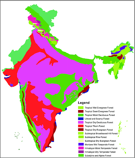
Types of Indian Forests
Tropical Wet Evergreen Forests
- Tropical wet evergreen forests can be found in the southern states of Maharashtra, Karnataka, Tamil Nadu, Kerala, and the Andaman and Nicobar Islands, as well as the entire northeastern region, including West Bengal‘s sub-mountain division.
- The annual rainfall is more than 250 cm.
- The average annual temperature is between 25 and 27 degrees Celsius.
- The average annual humidity is around 77 percent, and the dry season is only a few months long.
- They have scant undergrowth with clearings in between.
- They don’t have a lot of litter (organic matter settling on the ground).
- Mahogany, mesua, white cedar, jamun, canes, bamboo, and other valuable species can be found in these forests.
Tropical Semi-Evergreen Forests
- Tropical Semi-Evergreen Forests are basically classified as a transitional type of forest between tropical wet evergreen and tropical deciduous forests. In comparison to tropical wet evergreen forests, these are drier places.
- The tropical semi-evergreen forests are distributed on the Western coast, Assam, the lower slopes of the Eastern Himalayas, Odisha, and Andaman Island.
- The average annual rainfall is 200-250 cm.
- The average yearly temperature ranges from 24 to 27 degrees Celsius.
- Teak, Jamun, cashew, hog plum, coral tree, jasmine, and crossandra are some of the indigenous and exotic tree and plant species found in this forest.
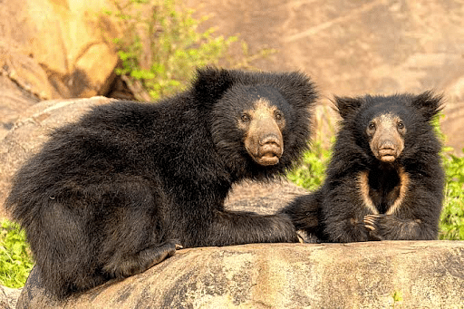
- Indian Leopard, Indian- giant Squirrel, Lemur, Deer, One-Horned Rhinos, Birds, Great Horn Bill, Bats, Sloth, Scorpions, Snails are prominent here.
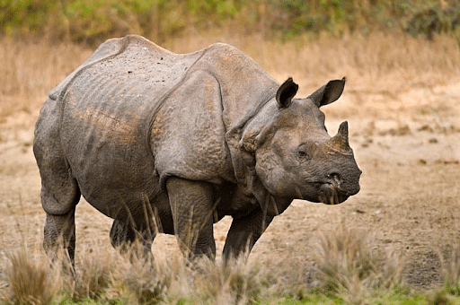
Vulnerable One-Horned Rhinos
Tropical Moist Deciduous Forests
- Tropical moist deciduous forests are one of the most common forests in India.
- Except in the western and northwestern parts of India, moist deciduous forests may be found practically everywhere.
- These forests can be found in places with rainfall ranging from 100 to 200 cm.
- Since topsoil is frequently washed away driven by strong rains, these forests may have poor soil.
- The Sal, as well as other species such as Adina Cardifolia (Kusum), Xylia Xylocarpa, Anogeissus Iatifolia (Dhau), and Machilus Villosa, congregate in the hetrogeneous deciduous zone.
- The Hoolok Gibbon, (also known as Yongmu) the only ape in India, is found in the tropical moist deciduous forests of Manipur.
- The tropical moist deciduous forests are one of the best forests in terms of export, import, and revenue, according to India’s economic resource pooling.

Endangered Hoolok Gibbon
Littoral and Swamp
- Littoral and Swamp Forests are abundant throughout India.
- They’re mostly found in Deccan Plateau reservoirs, Gujarat‘s saline coast, Rajasthan‘s saline coast, the Gulf of Kutch, Eastern Coast Deltas, Kashmir‘s lakes and rivers, and North East India‘s swamps.
- Swamp forests form where inadequate drainage and permanent soil waterlogging are caused by topography.
- Due to this obvious unique hydrologic environment, plant debris tends to accumulate on the forest floor, where it can contribute to the creation of thick peat deposits over time.
- The majority of the trees are evergreen. During low tides, they usually produce tangled webs of arching roots that are visible.
- The mangrove ecosystem is extremely productive, providing shelter and a nursery for a variety of fish species as well as other animals in the vicinity.
Tropical Dry Deciduous Forest
- The tropical moist deciduous forests are one of the best forests in terms of export, import, and revenue, according to India’s economic resource pooling.
- The dry deciduous forests of India are predominantly found in North India and the Deccan Plateau’s southern parts.
- They can also be found in the plains of Bihar, Uttar Pradesh, and the Peninsular plateau’s northeastern regions.
- The soil of tropical dry deciduous forests are generally nutrient-poor.
- Teak (Tectona grandis), coromandel ebony (Diospyros melanoxylon), dhaora (Anogeissus latifolia), Lagerstroemia parviflora, Terminalia tomentosa, Lannea coromandelica, Hardwickia binata, and Boswellia serrata are the main canopy trees found here.
- The Bengal tiger (Panthera tigris tigris), together with gaur (Bos gaurus), packs of dhole or Asiatic wild dog (Cuon alpinus), sloth bear (Melursus ursinus), chousingha (Tetracerus quadricornis), and blackbuck (Antilope cervicapra) live in the tropical dry deciduous forests of Madhya Pradesh, none of which are endemic.
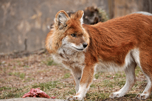
Enndangered Asiatic Wild Dog
Tropical Thorn Forests
- In India, tropical thorn forests can be found mostly in the northern parts along with some drier areas of the Deccan Plateau.
- The annual rainfall is less than 70cm.
- The vegetation is stunted and dominated by Acacia species that rarely reach 6 metres in height.
- Prosopis, Grewia, Salvadora, Zizyphus, Anogeissus, Gardenia, Capparis, and Carissa are among the other trees and shrubs that make up the forest community.
- Wild cats such as the common leopard, caracal, Indian desert cat, jungle cat, and rusty-spotted cat, as well as canids such as grey wolf, golden jackal, desert fox, Indian fox, and striped hyena, live in this ecoregion.
- There are various herbivorous animals in addition to these diversified carnivore species.
Tropical Dry Evergreen Forest
- The Tropical Dry Evergreen Forests are unique forests that can only be found in Tamil Nadu and Andhra Pradesh.
- Its distribution is limited to a short coastal strip that stretches from Vishakapattinam in Andhra Pradesh to Ramanathapuram in Tamil Nadu in the south.
- Rainfall distribution varies along a gradient from south to north and east to west throughout the coastal region.
- A larger percentage of fine pores was found in the soil of tropical dry evergreen woods.
- The clay content of the soils in this forest was clearly higher.
- Ceylon wood, Spanish Cherry, Ceylon ebony, Nux-vomica, Eugenia, veerai Tree, and Indian plum are the most common autotrophic species.
- The dhole (Cuon alpinus), sloth bear (Melursus ursinus), and Indian spotted chevrotain are among the consumers present in this ecoregion (Moschiola Indica).
Vulnearable Sloth Bear
Subtropical Broad-Leaved Forests
- The subtropical broadleaf forests ecoregion stretches from central Nepal’s middle hills through Darjeeling and Bhutan, as well as into Uttar Pradesh and Bihar in India.
- It comprises an east-west-directed strip of subtropical broadleaf forest in the Outer Himalayan Range at a height of 500 to 1,000 m (1,600 to 3,300 ft).
- The amount of rainfall varies from east to west, but annual rainfall might reach 2,000 mm.
- The forests are tall, with trees reaching 30 to 50 meters in height.
- Sal, or Shorea robusta, as well as Terminalia, Bauhinia, Schima, and Castanopsis species, are common in these forests.
- The Bengal tiger, Indian elephant, smooth-coated otter, clouded leopard, gaur, Sumatran serow, Irrawaddy squirrel, and particolored flying squirrel are among the ecoregion’s threatened mammals.
- The endemic golden langur has a narrow range and is only found north of the Brahmaputra River in the broadleaf forest.
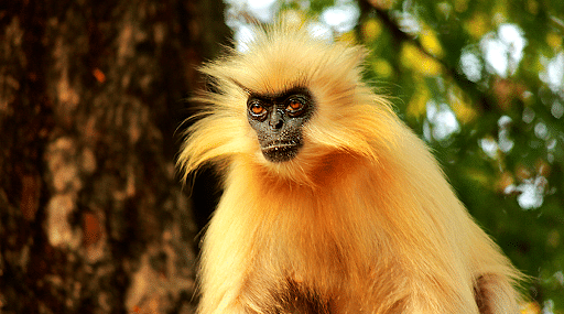
Endemic Golden Langur
Subtropical Pine Forests
- Subtropical pine forests cover a large area between 800 and 2000 meters in height in all of northeast India’s hilly states.
- The southwestern monsoon, which arrives from the Bay of Bengal and lasts from May to September, is responsible for the majority of the rainfall in the subtropical pine forests.
- The rocks are covered with a thin layer of leached, nutrient-poor soil, which serves as the plant’s rooting medium.
- Shisham, Teak, Sal, Pine, Fir, Juniper, and Rhododendron are the most common trees found in Himalayan subtropical pine forests.
- Except for a few goral (a goat-like mammal) and little barking deer, the ecoregion does not support many grazing or browsing herbivores due to a lack of vegetation and browse.
- The ecoregion does not support stable populations of large carnivores since wild prey is scarce.
- The bird fauna is more diverse however it is shared with neighboring ecoregions.
Subtropical Dry Evergreen Forests
- The subtropical dry evergreen forests are found in the western Himalayas, the Bhabar and the Shiwaliks up to 1000 meters above sea level.
- The average annual rainfall is only 800 millimeters.
- The majority of the precipitation falls between October and December, during the brief northeast monsoon.
- The flora and fauna of the ecoregion have adapted to the hot, dry climate.
- Manilkara hexandra, Diospyros ebernum (Ceylon ebony), Strychnos nuxvomica (strychnine tree), Drypetes sepiaria and Flacourtia indica are some of the most prevalent trees (Indian plum).
- These forests also include the globally threatened lesser florican and numerous huge, uncommon birds like the woolly-necked stork, white-bellied sea-eagle, and Indian gray hornbill, the bird diversity is greater.
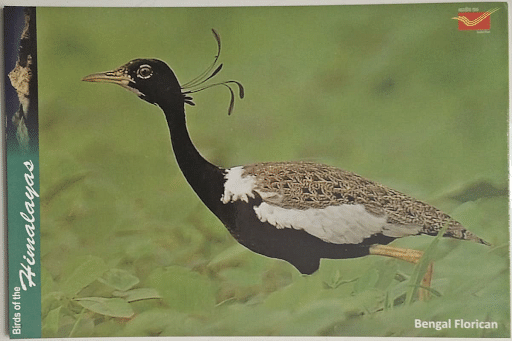
Florican
Montane Wet Temperate Forests
- Montane Wet Temperate Forests are distributed on mountains of moderate height.
- These Montane Wet Temperate Forests are distributed in the southern parts of India i.e., in Kerala and Tamil Nadu‘s upper mountainous areas.
- They can also be found in the east of 88°E longitude in the Eastern Himalayas, which includes the hills of Assam, West Bengal, Sikkim, Arunachal Pradesh, and Nagaland.
- The average annual rainfall ranges from 150 to 300 cm.
- The average annual temperature is between 11 and 14 degrees Celsius.
- Cullenia exarillata, Mesua ferrea, Palaquium ellipticum, Gluta travancorica, and Nageia wallichiana are typical canopy trees.
- Nilgiri tahr (Nilgiritragus hylocrius), Nilgiri pipit (Anthus nilghiriensis), Nilgiri laughingthrush (Montecincla cachinnans), broad-tailed grassbird (Schoenicola platyurus), and Nilgiri long-tailed tree mouse are all endemic to this ecoregion (Vandeleuria nilagirica).
Endangered Nilgiri tahr
Himalayan Moist Temperate Forest
- The Himalayan moist temperate forests, which grow between 1500 and 3300 metres above sea level extend the entire length of the mountain range in Kashmir, Himachal Pradesh, Uttaranchal, Darjeeling, and Sikkim.
- The himalayan moist temperate forests include 150 to 250 cm of annual rainfall.
- Precipitation is mostly caused by cyclonic disturbances from the Mediterranean Sea throughout the winter.
- The rainfall ranges from 1000 to 2500 mm, with an altitudinal range of 1500 to 5500 metres.
- Sandy soils are common to the east of the Tista River.
- Broad-leaved evergreens coexist alongside dominating conifers in the wetter east.
- The most important trees include pines, cedars, silver firs, spruce, and others.
- They grow in a high, open forest with a shrubby understory of oaks, rhododendrons, laurels, and bamboos.
- The Royal Bengal Tiger, barking deer, and Himalayan Black Bear are among the prominent species.

Vulnearable Himalayan Black Bear
Himalayan Dry Temperate Forest
- Himalayan Dry Temperate Forest is an open evergreen forest with an undergrowth of open scrub.
- These forests are mostly found in the Himalayas’ middle altitudes.
- Summers are mild and warm, with maximum temperatures rarely surpassing 32 degrees Celsius.
- Winters are lengthy and cold, with temperature fluctuations. The average yearly temperature is 5-16 degrees Celsius, with minimum temperatures below 0 degrees Celsius.
- The soil is light, rocky, and undeveloped.
- The forests have a combination of temperate zone conifers like the deodar, blue pine, fir, and spruce.
- Broad-leaved varieties may coexist with conifers in relatively small amounts, especially in wet, shady depressions.
- The snow leopard, Tibetan wolf, Tibetan argali, and black-necked crane are among the endangered wildlife of Ladakh.
Vulnerable Snow Leopard
Subalpine Forest
- The subalpine forest is a transition zone between dense forest below the treeline and alpine tundra above.
- It is a conifer-dominated forest found primarily in temperate latitudes’ subalpine zone, with a few extensions south of the Tropic of Cancer.
- These forests are usually found on north-facing slopes that are steep and rocky.
- Abies spectabilis, Larix griffithii, Betula utilis, Acer and Sorbus are the most common trees.
- This ecoregion is home to a diverse range of animal species.
- The brown bear, as well as rare or endangered species including the Himalayan serow and the markhor goat, are important inhabitants of this forest.
- Other important inhabitants include the white-bellied musk deer, which is hunted for its musk glands, and the endangered red panda.

Endangered Red Panda
Moist Alpine Scrub
- The Moist Alpine Scrub is a type of alpine forest that occurs from 3,000 meters up to the snowline.
- They can be found in both the main Himalayan regions and the trans himalayan barren freezing desserts.
- The climate varies from subarctic to arctic. The Moist Alpine Scrub receives heavy snowfall.
- Lower alpine grasslands are abundant, with vegetation that does not rise over 1.5 meters.
- Trees are stunted and infrequent, growing in between shrubs and meadows.
- The black juniper and drooping juniper dominate the environment.
- Rhododendrons also thrive at lower elevations, close to the treeline.
- Larger mammals found in these forests include Snow leopards (Uncia uncia), Himalayan blue sheep (Pseudois nayaur), Himalayan tahr (Hemitragus jemlahicus), takin (Budorcas taxicolor), Himalayan musk deer (Moschus chrysogaster), Himalayan goral (Naemorhedus baileyi), and Himalayan serow (Nemorhaedus bailey).
Critically Endangered Himalayan Rhododendron
Dry Alpine Scrub
- The Dry Alpine Scrub is a type of alpine forest that occurs over 3500 meters above sea level.
- In shaded depressions and along streams generated by snow melt waters, the scrub thrives.
- Dry arctic conditions prevail, with snowfall lasting for 5 to 6 months each year.
- The annual rainfall is usually less than 370 millimeters.
- There are no trees. Shrubs and pasture areas coexist.
- Juniperus wallichiana, Lonicera spp., and Potentilla spp. are characteristic plants of the dry alpine scrub forests.
- Giant, endangered species like snow leopards and Tibetan wolves roam the landscapes.
- These species hunt large mountain goats and sheep like goral, serow, Himalayan tahr, argali, and blue sheep, which are plentiful.
Near Threatened Argali
Importance of Forest
- Forests provide habitats to millions of animals and support numerous ecosystems.
- About 90 percent of all earth’s species dwell in forests.
- Forests serve as watershed regions because nearly all of the water in forest areas comes from forest-derived water tables as well as rivers, lakes, and streams.
- The forest cover protects streams and rivers passing through forests from the sun’s radiation and drying.
- Forests act as a repository for biodiversity genes.
- This is due to the fact that forests contain around 90% of all plant and animal species on the planet, resulting in a diverse range of plant and animal life forms in distinct forest settings.
- Forests serve a vital part in purifying the air we breathe. During the day, trees and plants take carbon dioxide and release oxygen through photosynthesis.
- Because trees and plants regulate atmospheric temperatures through evapotranspiration and provide an environmental breeze, forests act as climate stabilizers.
- Plants and trees assist in the recycling of soil nutrients by shedding leaves and small branches.
- Plant and tree roots also help to break down soil into smaller particles and increase water infiltration.
- Forests also have a role in the natural cycle of water evaporation, condensation, and precipitation in the form of rain.
Threats to the Forest
- Climate change is one of the most pressing issues confronting the planet today.
- While forests can aid in the fight against climate change, they are also extremely vulnerable to changing weather patterns.
- The type of forest that can grow in a given region is determined by the climate.
- Forests must adapt to changing climate conditions. The adaptation process, on the other hand, frequently takes longer than the changing climate conditions allow.
- Deforestation has the potential to have a significant detrimental influence on forest biodiversity.
- Deforestation is projected to be responsible for the loss of 13 million hectares of forest each year, according to the UN Food and Agriculture Organization (FAO).
- Natural disturbances are working with climate change to accelerate the further degradation of forests.
- Invasive plant and insect species are gaining an advantage over native species as a result of climate change.
Conclusion
Thus the conservation measures should be taken by the center, state and well as in community level by engaging the local population. Few measures include Regulated and planned cutting of trees, control over a forest fire, checking of forest clearance for agricultural and habitation purposes, proper utilization of forest and forest products, and reforestation, and afforestation programs. The Ministry of Environment, Forests and Climate Change is in charge of implementing India’s environmental and forestry programs, which include national park management, protection of India’s flora and wildlife, and pollution control.
- Drought refers to a temporary decrease in water or moisture availability below the anticipated level for a specific duration.
- It manifests as significantly lower-than-average precipitation during a season that typically receives sufficient rainfall to support both cereal and non-cereal crops.
- In India, the erratic nature of the summer monsoon, characterized by prolonged dry spells and high temperatures, contributes to drought conditions.
- On average, one out of every five years is categorized as a drought year nationwide, while in Rajasthan, this occurs approximately once in every three years.
- Drought is a relative phenomenon, as its inadequacy is measured against prevailing agro-climatic conditions.
- Unlike aridity, which is a permanent condition, drought is a temporary situation.
- Regions classified as arid or semi-arid are more susceptible to drought due to their climatic characteristics.
TYPES AND CAUSES OF DROUGHT
1. Meteorological Drought:
- This type of drought occurs when there is a significant reduction in rainfall over a specific period compared to the climatological average for that area.
- The Indian Meteorological Department (IMD) defines a drought as a situation where the average annual rainfall is less than 75% of the normal.
- The uneven distribution of rainfall, caused by erratic and concentrated precipitation patterns, often leads to frequent droughts despite India’s average annual rainfall of 110 cm.
Causes of Meteorological Droughts:
- Below-average monsoon and lean rainfall.
- Delayed onset or early withdrawal of monsoons.
- Prolonged interruptions in monsoon activity.
2. Hydrological Drought:
- This type is characterized by a decrease in water levels, with surface water droughts affecting resources such as rivers, lakes, and reservoirs, while groundwater droughts involve a decline in groundwater levels.
Causes of Hydrological Drought:
- Extensive deforestation.
- Environmentally harmful mining practices.
- Excessive extraction of groundwater.
3. Agricultural Drought:
- Agricultural drought occurs when soil moisture falls below the level required to sustain plant growth, resulting in crop failures due to erratic rainfall and insufficient soil moisture.
Causes of Agricultural Droughts:
- Excessive reliance on High Yielding Seeds (HYV) that demand more water and proper irrigation.
- Alteration in cropping patterns, such as the increased cultivation of water-intensive crops like rice in regions with limited water availability.
4. Socio-Economic Drought:
This type reflects a reduction in food availability and income loss resulting from crop failure.
5. Ecological Drought:
Ecological drought occurs when the natural ecosystem’s productivity declines due to water shortages, leading to environmental damage such as the death of livestock, wildlife, and trees in forests.
DROUGHT MANAGEMENT
Drought management involves a comprehensive approach encompassing three key components, each requiring a holistic strategy to ensure effective outcomes:
Drought Intensity Assessment and Monitoring:
- This component focuses on assessing the severity of drought conditions and continuously monitoring the situation.
- It involves utilizing various indicators to measure drought intensity, such as rainfall patterns, soil moisture levels, groundwater levels, and crop health.
- Continuous monitoring helps in early detection of drought conditions, allowing for timely intervention and mitigation measures.
Drought Declaration and Prioritization of Affected Areas:
- Once drought conditions are identified, the next step is to declare drought and prioritize areas affected by it for effective management.
- This involves analyzing the severity of drought impact on different regions, communities, and population groups.
- Prioritization helps in allocating resources and implementing targeted interventions where they are most needed.
Development and Implementation of Drought Management Strategies:
- This component focuses on developing comprehensive strategies to manage drought effectively.
- It includes measures to mitigate the impact of drought on various sectors such as agriculture, water resources, livestock, and human health.
- Strategies may include water conservation measures, crop diversification, livestock management practices, and public health interventions.
- Implementation of these strategies requires coordination among various stakeholders and government agencies.
NDMA Guidelines for Drought Management
The National Disaster Management Authority (NDMA) provides guidelines for effective drought management, which include:
Development of Vulnerability Profiles:
NDMA guidelines emphasize the importance of developing vulnerability profiles for regions, communities, and population groups. These profiles compile critical information related to drought vulnerability, which, when integrated into planning processes, enhances the identification and prioritization of specific areas for intervention.
Establishment of Drought Management Cells (DMCs):
Specific Drought Management Cells are recommended to be set up at the state level under the State Disaster Management Authority (SDMA). These DMCs are tasked with preparing vulnerability maps for their respective states, with a focus on arid and semi-arid areas that are most vulnerable to recurring droughts.
Use of Information and Communication Technology (ICT):
NDMA guidelines advocate for the utilization of Information and Communication Technology (ICT) tools and the role of the National Informatics Center (NIC) for online interaction and the availability of real-time drought-related information. This facilitates assessment, early warning, and decision-making processes during drought management.
Assessment of Expected Damage:
NDMA guidelines stress the importance of assessing expected damage caused by drought, including its impact on agricultural production, water resources, livestock, land degradation, deforestation, and human health. This assessment helps in planning and implementing appropriate response measures to mitigate the effects of drought on affected sectors and communities.
Koppen Climate Classification System is by far the most widely used modern climate classification system.
So, Let’s get to know the Koeppen’s scheme of classification of climate. So this person Wladimir Köppen, who was basically a Russian-German climatologist, he classified the climate of the world by finding a close relationship between the vegetation and the climate of a particular region.
His aim was to make a chart with formulas and notations that would define the climatic boundaries in such a way that it showed close similarity with the existing vegetation.
In simple terms, he looked at the trees and plants of a particular region and then he figured out the relationship between the vegetation and the climate of that region. By finding a close relationship between the two, he created a chart which categorized different climates in groups along with its characteristic traits.
He selected certain values of temperature and precipitation and related them to the distribution of vegetation and used these values for classifying the climates.
He classified the entire world climate by assigning alphabetical letters (capital letters) – A, B, C, D, E, and H. These categories are further subdivided into subdivisions and types by indicating small letters like – a, b, c, d, h, f, m, w, k, and s.
But, Before we discuss in detail the Koppen Climate Classification System, Let’s have a look at the differences between weather and climate.
Differences between weather and climate –
| Climate | Weather | |
| Definition | Describes the average conditions expected at a specific place at a given time (considerable time). A region’s climate is generated by the climate system, which has five components: atmosphere, hydrosphere, cryosphere, land surface, and biosphere. | Describes the atmospheric conditions at a specific place at a specific point in time. Weather generally refers to day-to-day temperature and precipitation activity |
|---|---|---|
| Components | Climate may include precipitation, temperature, humidity, sunshine, wind velocity, phenomena such as fog, frost, and hail storms over a long period of time. | Weather includes sunshine, rain, cloud cover, winds, hail, snow, sleet, freezing rain, flooding, blizzards, ice storms, thunderstorms, steady rains from a cold front or warm front, excessive heat, heat waves and more |
| Forecast | By aggregates of weather statistics over periods of 30 years | By collecting meteorological data, like air temperature, pressure, humidity, solar radiation, wind speeds and direction etc. |
| Determining factors | Aggregating weather statistics over periods of 30 years (“climate normals”). | Real-time measurements of atmospheric pressure, temperature, wind speed and direction, humidity, precipitation, cloud cover, and other variables |
| About | Climate is defined as statistical weather information that describes the variation of weather at a given place for a specified interval. | Weather is the day-to-day state of the atmosphere, and its short-term (minutes to weeks) variation |
| Time period | Measured over a long period | Measured for short term |
| Study | Climatology | Meteorology |
Koppen Climate Classification System
Wladimir Köppen (1846– 1940; pronounced like “kur-pin” with a silent r) was a Russian-born German climatologist who was also an amateur botanist.
The first version of his climate classification scheme appeared in 1918, and he continued to modify and refine it for the rest of his life, the last version being published in 1936.
The modified Köppen system describes five major climate groups (groups A, B, C, D, and E) which are subdivided into a total of 14 individual climate types, along with the special category of highland (H) climate.


- Koeppen recognized five major climatic groups, four of them are based on temperature and one on precipitation.
- The capital letters:
- A, C, D, and E delineate humid climates and
- B dry climates.
- The climatic groups are subdivided into types, designated by small letters, based on seasonality of precipitation and temperature characteristics.
- The seasons of dryness are indicated by the small letters: f, m, w, and s, where
- f – no dry season,
- m – monsoon climate,
- w – winter dry season and
- s – summer dry season.
- The above mentioned major climatic types are further subdivided depending upon the seasonal distribution of rainfall or degree of dryness or cold.
- a: hot summer, the average temperature of the warmest month over 22°C
- c: cool summer, the average temperature of the warmest month under 22°C
- f: no dry season
- w: the dry season in winter
- s: the dry season in summer
- g: Gange’s type of annual march of temperature; hottest month comes before the solstice and the summer rainy season.
- h: average annual temperature under 18°C
- m (monsoon): short dry season.
- The capital letters S and W are employed to designate the two subdivisions of dry climate:
- semi-arid or Steppe (S) and
- arid or desert (W).
- Capital letters T and F are similarly used to designate the two subdivisions of polar climate
- tundra (T) and
- icecap (F).


A – Tropical Moist Climates

Tropical moist climates can be found about 15 to 25 degrees latitude northwards and southwards of the equator. The distinctive feature of this climactic zone is that temperatures in these zones remain above 18 degrees Celcius all throughout the year. Annual precipitation in this climactic zone is usually above 1,500 mm.
Within this broad climatic zone, three minor climactic types also exist, whose classification is based on the seasonal distribution of rainfall in these climatic zones. Areas falling under these climatic zones usually consist of naturally dense tropical forests.
The first is Af, or tropical wet climate, where the climate is tropical with precipitation all year round.
- Monthly variations in temperature in these regions are less than about 3 degrees C.
- The extremely high humidity and surface temperatures in these regions cause cumulus and cumulonimbus clouds to form early into the afternoons every day, resulting in a high amount of precipitation.
The second is a tropical monsoon climate, designated as Am.
- In these regions, the annual precipitation is nearly similar to that of Af, but here most of the precipitation occurs within the 7 to 9 of the warmest months of the year.
- Less rainfall occurs in these regions in the rest of the year.
The third sub-division is Aw, or the tropical wet and dry climate, or the savanna climate.
- These climactic zones experience an extended dry season during the winter season.
- During the wet season, precipitation is usually less than 1,000 mm and occurs mostly during the summer season.
B – Dry Climates

Temperature is not as much of a factor in these climatic zones as precipitation, or rather the lack of it is in these climatic zones. In these climatic zones, evaporation and transpiration exceed the total precipitation. These climactic regions extend 20 to 35 degrees latitude northwards and southwards from the equator and are present in large continental regions in the mid-latitudes or are encircled by mountainous regions.
There are four broad sub-divisions of this climactic zone.
The first is BW, or dry arid climate also called the true desert climate and covers about 12 percent of the Earth’s total land area.
- Areas falling under this climatic zone are habitats for xerophytic vegetation.
- The letters h and k are suffixed after BW to signify whether the dry arid zone is located in the sub-tropics or the mid-latitudes respectively.
The second is BS, or dry semi-arid climate, also referred to as steppe climate.
- This forms a sort of grassland climate that is present on about 14 percent of the Earth’s surface.
- Regions coming under dry semi-arid climate or BS receives more precipitation than the regions under the dry arid climate or BW, which is mainly due to mid-latitude cyclones or due to the inter-tropical convergence zone.
The letters h and k are suffixed in a similar way to BW zones to define the location of the climatic zone in the sub-tropics or in the mid-latitudes respectively.
C – Moist Sub-tropical Mid-latitude Climates

In this climactic zone, summers are usually warm and humid while winters are mild. These climactic zones extend 30 to 50 degrees latitude northwards and southwards from the equator and are present mainly at the eastern and western extremes of most continents.
Summer months feature many convective thunderstorms and winter months feature some mid-latitude cyclones. Three subdivisions exist for this form of the climactic zone.
The first is the humid subtropical climate or Cfa, where summers are hot and humid with frequent thunderstorms.
- The winters are comparatively mild and precipitation during this period occurs due to mid-latitude cyclones, like in the southeastern USA for example.
The second is the Cfb marine climates that are usually found on the western coasts of continents.
- The climate here is largely humid with a hot and dry summer.
- Winters are mild, although accompanied by heavy precipitation due to mid-latitude cyclones.
The third is the Mediterranean climatic zone or Cs, where rainfall mostly occurs during the mild winters due to the mid-latitude cyclones.
- Precipitation during the summer months in this climactic zone can be extremely scanty. Areas falling under this climatic zone can include locations in Portland, Oregon, and California for example.
D – Moist Continental Mid-latitude Climates

In moist continental mid-latitude climates, summers are warm and can also be cool while winters are cold. The regions with moist continental mid-latitude climates are usually located polewards from the moist sub-tropical mid-latitude climates or C climates. Average temperatures in the warmest months are usually more than 10 degrees C, while temperatures in the coldest months can be less than minus 3 degrees C.
Winters in these regions can be bitterly cold, with strong winds and snowstorms that flow from the Continental Polar and the Arctic air masses.
There are three sub-divisions in this form of Koppen climate classification, namely, Dw – with dry winters, Ds – with dry summers, and Df – with precipitation all year round.
E – Polar Climates

In Polar climates, temperatures are low all year round with the warmest month having temperatures less than 10 degrees C. Polar climates occur in the northern coastal areas of Asia, Europe, and North America and on Greenland and Antarctica. Polar climates have two sub-divisions.
The first is ET or Polar Tundra in which soil occurs as permanently frozen as permafrost extending hundreds of meters in depth. Most vegetation found here occurs in the form of dwarf trees, woody shrubs, lichens, and mosses.
The second is EF or Polar Ice Caps, which have a surface that is permanently covered with ice or snow.
Pros of Koppen Classification
- Quantitative: easier to understand and measure
- Co-incides with vegetation pattern
- Gave importance to effective precipitation (evapotranspiration)
Cons of Koppen Classification
- Too much emphasis on average values
- Koppen based his classification of the mean monthly values of temperature and precipitation. By these statistics, the most potent factor of precipitation can only be estimated, rather than measured accurately. This makes comparison from one locality to another rather difficult.
- Ignored precipitation intensity, cloud cover, daily temperature variations, number of rainy days, etc.
- Koppen did not take into account such weather elements as winds, precipitation intensity, amount of cloudiness, and daily temperature extremes for the sake of making his classification generalized and simple.
- Ignored the role of Air masses
- It is empirical and, therefore, is based on facts and observations. The causative factors of climate have been totally ignored. Thus, the air masses, which form the very basis of modern climatology, could not find any place in Koppen’s classification
- Was not a genetic classification